 vesseltracker.com
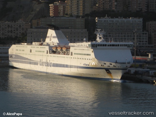
 Athara
Current Status
Where is the vessel?
Athara is currently in Near Naples, based on AIS data received about 1h ago.
Latest AIS update:
Current position: 40.84014° N, 14.26843° E (Near Naples)
Average speed (last 7 days): Loading…
Average speed (last 30 days): Loading…
Vessel profile: Athara is a Passenger Ro Ro Cargo Ship with dimensions 214m x 26m.
This page combines live AIS, route history, probable destination signals, nearby traffic, and port activity for practical vessel monitoring.
The current position of vessel Athara is 40.84014 lat / 14.26843 lng. Updated: 2026-05-15 04:26:53 UTCNearest reference points:
- Near Naples
- Near MERGELLINA
- Near Castellammare di Stabia
Currently sailing under the flag of Italy ![]()
Athara built in 2003 year
Deadweight:
4700 tDetails:
Live Vessel Athara Analytics (details, animations, etc.)
Recent AIS points (UTC):
2026-05-14 07:54:39 UTC · 40.84015, 14.26842 · SOG 0 kn · COG 91°2026-05-15 00:55:01 UTC · 40.84015, 14.26844 · SOG 0 kn · COG 88°
2026-05-15 00:55:01 UTC · 40.84015, 14.26844 · SOG 0 kn · COG 88°
2026-05-15 04:26:53 UTC · 40.84014, 14.26843 · SOG 0 kn · COG 88°