 vesseltracker.com
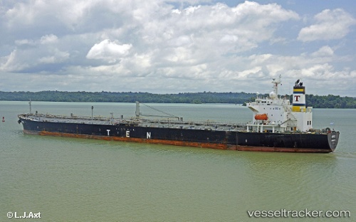
 ANDES
ANDES
Current Status
Where is the vessel?
ANDES is currently in Near PASIR GUDANG, based on AIS data received about 4h ago.
Latest AIS update:
Current position: 1.43523° N, 103.89390° E (Near PASIR GUDANG)
Average speed (last 7 days): Loading…
Average speed (last 30 days): Loading…
Vessel profile: ANDES is a Oil Products Tanker with dimensions 32m x 228m.
This page combines live AIS, route history, probable destination signals, nearby traffic, and port activity for practical vessel monitoring.
The current position of vessel ANDES is 1.43523 lat / 103.89390 lng. Updated: 2026-05-14 23:29:43 UTCNearest reference points:
- Near PASIR GUDANG
- Near Johor
- Near SEMBAWANG
Currently sailing under the flag of Liberia ![]()
ANDES built in 2003 year
Deadweight:
68439 tDetails:
Live Vessel ANDES Analytics (details, animations, etc.)
Recent AIS points (UTC):
2026-05-14 20:11:44 UTC · 1.43523, 103.89392 · SOG 0.1 kn · COG 113°2026-05-14 22:11:43 UTC · 1.43522, 103.89390 · SOG 0 kn · COG 113°
2026-05-14 22:20:41 UTC · 1.43522, 103.89393 · SOG 0 kn · COG 113°
2026-05-14 23:29:43 UTC · 1.43523, 103.89390 · SOG 0 kn · COG 113°