 vesseltracker.com
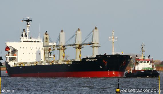
 BSL NORDIC
Current Status
Where is the vessel?
BSL NORDIC is currently in 13 nm W of Hulaylah Terminal, based on AIS data received less than 1h ago.
Latest AIS update:
Current position: 25.97690° N, 55.69038° E (13 nm W of Hulaylah Terminal)
Average speed (last 7 days): Loading…
Average speed (last 30 days): Loading…
Vessel profile: BSL NORDIC is a Bulk Carrier with dimensions m x m.
This page combines live AIS, route history, probable destination signals, nearby traffic, and port activity for practical vessel monitoring.
The current position of vessel BSL NORDIC is 25.97690 lat / 55.69038 lng. Updated: 2026-04-27 15:27:36 UTCNearest reference points:
- 13 nm NW of Hulaylah Terminal
- Near Hulaylah Terminal
- 20 nm NW of Hulaylah Terminal
Currently sailing under the flag of Saint Kitts and Nevis ![]()
Details:
Live Vessel BSL NORDIC Analytics (details, animations, etc.)
Recent AIS points (UTC):
2026-04-27 11:54:36 UTC · 25.97780, 55.69065 · SOG 0.1 kn · COG 260°2026-04-27 13:00:36 UTC · 25.97765, 55.69078 · SOG 0 kn · COG 267°
2026-04-27 13:42:37 UTC · 25.97757, 55.69075 · SOG 0 kn · COG 270°
2026-04-27 15:27:36 UTC · 25.97690, 55.69038 · SOG 0 kn · COG 303°