 vesseltracker.com
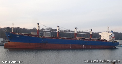
 TONG DE 188
Current Status
Where is the vessel?
TONG DE 188 is currently in 37 nm NE of Thuan An, based on AIS data received about 1h ago.
Latest AIS update:
Current position: 15.97616° N, 109.06364° E (37 nm NE of Thuan An)
Average speed (last 7 days): Loading…
Average speed (last 30 days): Loading…
Vessel profile: TONG DE 188 is a Bulk Carrier with dimensions m x m.
This page combines live AIS, route history, probable destination signals, nearby traffic, and port activity for practical vessel monitoring.
The current position of vessel TONG DE 188 is 15.97616 lat / 109.06364 lng. Updated: 2026-05-16 06:06:04 UTCNearest reference points:
- 23 nm E of Hai Son
- Near DUNG QUAT
- Near Thuan An
Currently sailing under the flag of Panama ![]()
Details:
Live Vessel TONG DE 188 Analytics (details, animations, etc.)
Recent AIS points (UTC):
2026-05-16 01:12:54 UTC · 16.72748, 109.56480 · SOG 11.1 kn · COG 217°2026-05-16 03:18:14 UTC · 16.40662, 109.33460 · SOG 10 kn · COG 216°
2026-05-16 04:48:14 UTC · 16.17783, 109.18327 · SOG 10.5 kn · COG 209°
2026-05-16 06:06:04 UTC · 15.97616, 109.06364 · SOG 11 kn · COG 212°