 vesseltracker.com
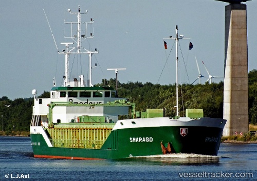
Smaragd
Current StatusWhere is the vessel?
Smaragd is currently in Near Gelves, based on AIS data received about 1h ago.
Latest AIS update:
Current position: 37.33640° N, 5.99616° W (Near Gelves)
Average speed (last 7 days): Loading…
Average speed (last 30 days): Loading…
Vessel profile: Smaragd is a General Cargo Ship with dimensions 13m x 90m.
This page combines live AIS, route history, probable destination signals, nearby traffic, and port activity for practical vessel monitoring.
The current position of vessel Smaragd is 37.33640 lat / -5.99616 lng. Updated: 2026-04-05 11:36:01 UTCNearest reference points:
- Near Trebujena
- Near CHIPIONA
- Near El Puerto de Santa María
Details:
Live Vessel Smaragd Analytics (details, animations, etc.)
Recent AIS points (UTC):
2026-04-05 05:33:00 UTC · 37.33641, -5.99618 · SOG 0 kn · COG 333°2026-04-05 07:44:59 UTC · 37.33639, -5.99611 · SOG 0 kn · COG 333°
2026-04-05 10:09:01 UTC · 37.33638, -5.99619 · SOG 0 kn · COG 333°
2026-04-05 11:36:01 UTC · 37.33640, -5.99616 · SOG 0 kn · COG 333°