 vesseltracker.com
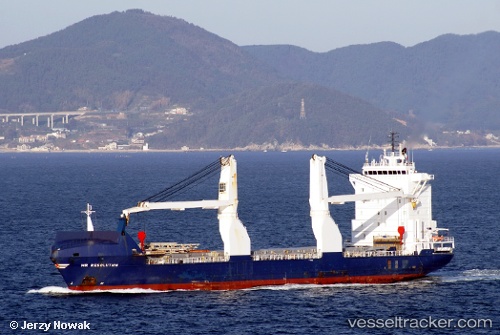
 Industrial Royal
Current Status
Where is the vessel?
Industrial Royal is currently in Near Rio De Janeiro, based on AIS data received about 1h ago.
Latest AIS update:
Current position: 22.89274° S, 43.19797° W (Near Rio De Janeiro)
Average speed (last 7 days): Loading…
Average speed (last 30 days): Loading…
Vessel profile: Industrial Royal is a Multi Purpose Carrier with dimensions 135m x 135m.
This page combines live AIS, route history, probable destination signals, nearby traffic, and port activity for practical vessel monitoring.
The current position of vessel Industrial Royal is -22.89274 lat / -43.19797 lng. Updated: 2026-05-14 04:06:17 UTCNearest reference points:
- Near Rio De Janeiro
- Near NITEROI
- Near Santos Dumont Apt/Rio de Janeiro
Currently sailing under the flag of Liberia ![]()
Industrial Royal built in 2005 year
Deadweight:
10536 tDetails:
Live Vessel Industrial Royal Analytics (details, animations, etc.)
Recent AIS points (UTC):
2026-05-14 02:03:17 UTC · -22.89273, -43.19801 · SOG 0 kn · COG 245°2026-05-14 02:51:20 UTC · -22.89280, -43.19803 · SOG 0 kn · COG 246°
2026-05-14 03:36:19 UTC · -22.89276, -43.19801 · SOG 0 kn · COG 245°
2026-05-14 04:06:17 UTC · -22.89274, -43.19797 · SOG 0 kn · COG 245°