 vesseltracker.com
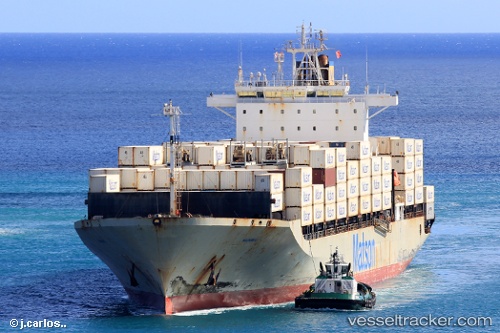
Maunawili
Current StatusWhere is the vessel?
Maunawili is currently in Near Vashon, based on AIS data received about 1h ago.
Latest AIS update:
Current position: 47.44971° N, 122.41395° W (Near Vashon)
Average speed (last 7 days): Loading…
Average speed (last 30 days): Loading…
Vessel profile: Maunawili is a Container Ship with dimensions 32m x 217m.
This page combines live AIS, route history, probable destination signals, nearby traffic, and port activity for practical vessel monitoring.
The current position of vessel Maunawili is 47.44971 lat / -122.41395 lng. Updated: 2026-05-15 13:58:07 UTCNearest reference points:
- Near Tacoma
- Near Interbay
- Near Boeing Field Apt
Details:
Live Vessel Maunawili Analytics (details, animations, etc.)
Recent AIS points (UTC):
2026-05-15 10:14:25 UTC · 48.17171, -123.31541 · SOG 15.7 kn · COG 80°2026-05-15 11:56:49 UTC · 48.04162, -122.64622 · SOG 17.8 kn · COG 167°
2026-05-15 13:53:18 UTC · 47.47462, -122.42273 · SOG 19.1 kn · COG 167°
2026-05-15 13:58:07 UTC · 47.44971, -122.41395 · SOG 19.2 kn · COG 156°