 vesseltracker.com
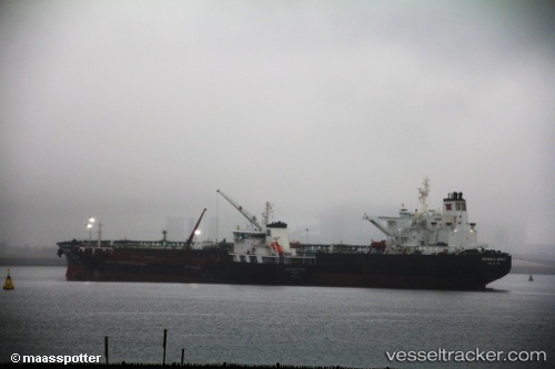
 NEW DISCOVERY
Current Status
Where is the vessel?
NEW DISCOVERY is currently in Near AQABA INDUSTRIAL, based on AIS data received about 2h ago.
Latest AIS update:
Current position: 29.41570° N, 34.89415° E (Near AQABA INDUSTRIAL)
Average speed (last 7 days): Loading…
Average speed (last 30 days): Loading…
Vessel profile: NEW DISCOVERY is a Crude Oil Tanker with dimensions 274m x 48m.
This page combines live AIS, route history, probable destination signals, nearby traffic, and port activity for practical vessel monitoring.
The current position of vessel NEW DISCOVERY is 29.41570 lat / 34.89415 lng. Updated: 2026-04-30 18:23:10 UTCNearest reference points:
- Near AQABA INDUSTRIAL
- Near Al Khuraibah
- 15 nm SW of Al Khuraibah
Currently sailing under the flag of Liberia ![]()
NEW DISCOVERY built in 2003 year
Deadweight:
159199 tDetails:
Live Vessel NEW DISCOVERY Analytics (details, animations, etc.)
Recent AIS points (UTC):
2026-04-30 16:22:49 UTC · 29.39680, 34.87202 · SOG 2.8 kn · COG 23°2026-04-30 17:49:39 UTC · 29.41917, 34.89299 · SOG 0.3 kn · COG 356°
2026-04-30 18:23:10 UTC · 29.41570, 34.89415 · SOG 0.5 kn · COG 56°
2026-04-30 18:23:10 UTC · 29.41570, 34.89415 · SOG 0.5 kn · COG 56°