 vesseltracker.com
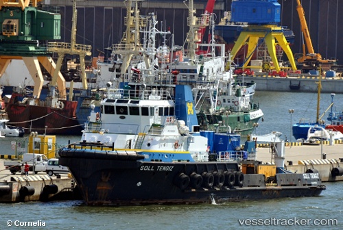
 Sl Tengiz
Current Status
Where is the vessel?
Sl Tengiz is currently in Near Nida, based on AIS data received less than 1h ago.
Latest AIS update:
Current position: 56.05094° N, 20.95051° E (Near Nida)
Average speed (last 7 days): Loading…
Average speed (last 30 days): Loading…
Vessel profile: Sl Tengiz is a Offshore Support Vessel with dimensions 48m x 48m.
This page combines live AIS, route history, probable destination signals, nearby traffic, and port activity for practical vessel monitoring.
The current position of vessel Sl Tengiz is 56.05094 lat / 20.95051 lng. Updated: 2026-05-15 01:00:46 UTCNearest reference points:
- Near Klaipeda
- Near Cimdenieki
- 39 nm W of Pilies juru uosto PVP/Klaipeda
Currently sailing under the flag of Lithuania ![]()
Sl Tengiz built in 2002 year
Deadweight:
791 tDetails:
Live Vessel Sl Tengiz Analytics (details, animations, etc.)
Recent AIS points (UTC):
2026-05-14 21:35:06 UTC · 56.05096, 20.95038 · SOG 0.1 kn · COG 184°2026-05-14 22:44:07 UTC · 56.05097, 20.95059 · SOG 0.1 kn · COG 189°
2026-05-15 00:02:07 UTC · 56.05098, 20.95058 · SOG 0.4 kn · COG 201°
2026-05-15 01:00:46 UTC · 56.05094, 20.95051 · SOG 0.3 kn · COG 199°