 vesseltracker.com
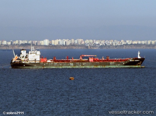
 MURLIKISHAN
Current Status
Where is the vessel?
MURLIKISHAN is currently in 28 nm SW of Dayyer, based on AIS data received about 2d ago.
Latest AIS update:
Current position: 27.44383° N, 51.63567° E (28 nm SW of Dayyer)
Average speed (last 7 days): Loading…
Average speed (last 30 days): Loading…
Vessel profile: MURLIKISHAN is a Oil/Chemical Tanker with dimensions m x m.
This page combines live AIS, route history, probable destination signals, nearby traffic, and port activity for practical vessel monitoring.
The current position of vessel MURLIKISHAN is 27.44383 lat / 51.63567 lng. Updated: 2026-05-11 20:20:52 UTCNearest reference points:
- Near Dayyer
- Near Sarooj Anchorage
- Near ASALUYEH
Currently sailing under the flag of Madagascar ![]()
Details:
Live Vessel MURLIKISHAN Analytics (details, animations, etc.)
Recent AIS points (UTC):
2026-05-11 17:25:13 UTC · 27.69283, 51.20350 · SOG 0 kn · COG 134°2026-05-11 20:20:52 UTC · 27.44383, 51.63567 · SOG 9.1 kn · COG 120°
2026-05-11 20:20:52 UTC · 27.44383, 51.63567 · SOG 9.1 kn · COG 120°
2026-05-11 20:20:52 UTC · 27.44383, 51.63567 · SOG 9.1 kn · COG 120°