 vesseltracker.com
 GAJA
GAJA
Current Status
Where is the vessel?
GAJA is currently in 13 nm SE of Amatikulu, based on AIS data received about 1h ago.
Latest AIS update:
Current position: 29.24739° S, 31.63818° E (13 nm SE of Amatikulu)
Average speed (last 7 days): Loading…
Average speed (last 30 days): Loading…
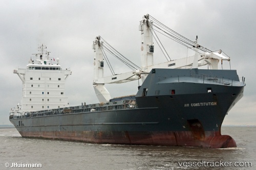
Vessel profile: GAJA is a General Cargo Ship with dimensions 157m x 21m.
This page combines live AIS, route history, probable destination signals, nearby traffic, and port activity for practical vessel monitoring.
The current position of vessel GAJA is -29.24739 lat / 31.63818 lng. Updated: 2026-05-14 02:07:18 UTCNearest reference points:
- Near Umhlanga Rocks
- Near Durban
- Near Island View
Currently sailing under the flag of Antigua and Barbuda ![]()
GAJA built in 2006 year
Deadweight:
12767 tDetails:
Live Vessel GAJA Analytics (details, animations, etc.)
Recent AIS points (UTC):
2026-05-13 22:44:57 UTC · -29.24047, 31.64762 · SOG 1.3 kn · COG 160°2026-05-14 00:13:08 UTC · -29.23841, 31.64414 · SOG 1.6 kn · COG 150°
2026-05-14 01:33:16 UTC · -29.24337, 31.64316 · SOG 0.7 kn · COG 186°
2026-05-14 02:07:18 UTC · -29.24739, 31.63818 · SOG 0.5 kn · COG 179°