 vesseltracker.com
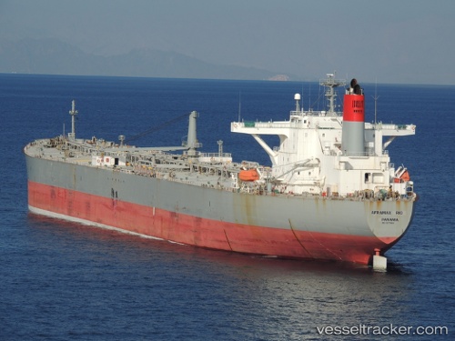
 AFRAMAX RIO
Current Status
Where is the vessel?
AFRAMAX RIO is currently in 19 nm SW of Nisiros, based on AIS data received less than 1h ago.
Latest AIS update:
Current position: 36.42687° N, 26.82600° E (19 nm SW of Nisiros)
Average speed (last 7 days): Loading…
Average speed (last 30 days): Loading…
Vessel profile: AFRAMAX RIO is a Crude Oil Tanker with dimensions m x m.
This page combines live AIS, route history, probable destination signals, nearby traffic, and port activity for practical vessel monitoring.
The current position of vessel AFRAMAX RIO is 36.42687 lat / 26.82600 lng. Updated: 2026-04-28 05:55:55 UTCNearest reference points:
- 20 nm S of Astypálaia
- Near KALYMNOS
- 11 nm E of GYALI
Currently sailing under the flag of Liberia ![]()
Details:
Live Vessel AFRAMAX RIO Analytics (details, animations, etc.)
Recent AIS points (UTC):
2026-04-28 01:35:53 UTC · 35.89208, 27.52785 · SOG 11.1 kn · COG 345°2026-04-28 04:20:46 UTC · 36.25087, 27.10595 · SOG 10.8 kn · COG 305°
2026-04-28 04:41:46 UTC · 36.28660, 27.04235 · SOG 10.7 kn · COG 308°
2026-04-28 05:55:55 UTC · 36.42687, 26.82600 · SOG 10.3 kn · COG 346°