 vesseltracker.com
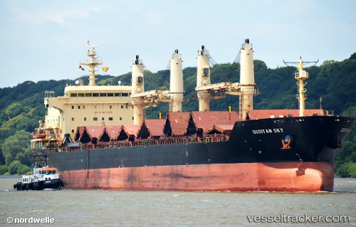
 RUI AN
Current Status
Where is the vessel?
RUI AN is currently in 41 nm W of Lushun New Pt, based on AIS data received about 2h ago.
Latest AIS update:
Current position: 38.58886° N, 120.31906° E (41 nm W of Lushun New Pt)
Average speed (last 7 days): Loading…
Average speed (last 30 days): Loading…
Vessel profile: RUI AN is a Bulk Carrier with dimensions m x m.
This page combines live AIS, route history, probable destination signals, nearby traffic, and port activity for practical vessel monitoring.
The current position of vessel RUI AN is 38.58886 lat / 120.31906 lng. Updated: 2026-05-14 07:53:09 UTCNearest reference points:
- 38 nm W of Lushun New Pt
- 32 nm NW of Changdao
- 38 nm NW of Changdao
Currently sailing under the flag of Liberia ![]()
Details:
Live Vessel RUI AN Analytics (details, animations, etc.)
Recent AIS points (UTC):
2026-05-14 05:31:50 UTC · 38.65029, 119.78395 · SOG 10.5 kn · COG 99°2026-05-14 06:29:49 UTC · 38.62718, 120.00137 · SOG 10.7 kn · COG 91°
2026-05-14 07:36:39 UTC · 38.59774, 120.25505 · SOG 11 kn · COG 97°
2026-05-14 07:53:09 UTC · 38.58886, 120.31906 · SOG 11.1 kn · COG 97°