 vesseltracker.com
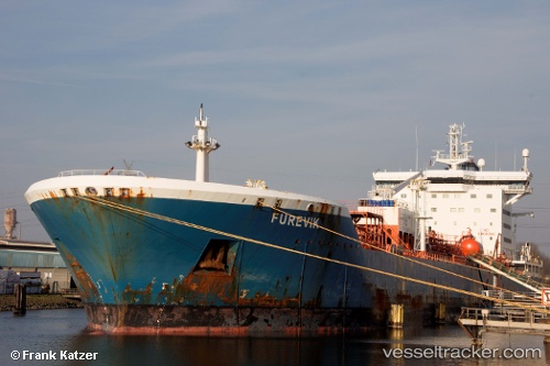
 KOCATEPE
Current Status
Where is the vessel?
KOCATEPE is currently in 41 nm W of Jeddah, based on AIS data received about 1h ago.
Latest AIS update:
Current position: 21.39828° N, 38.41494° E (41 nm W of Jeddah)
Average speed (last 7 days): Loading…
Average speed (last 30 days): Loading…
Vessel profile: KOCATEPE is a Chemical Oil Products Tanker with dimensions 186m x 32m.
This page combines live AIS, route history, probable destination signals, nearby traffic, and port activity for practical vessel monitoring.
The current position of vessel KOCATEPE is 21.39828 lat / 38.41494 lng. Updated: 2026-04-18 09:39:58 UTCNearest reference points:
- 64 nm W of Tusdeer Free Zone
- 67 nm W of Tusdeer Free Zone
- 10 nm SW of Jeddah
Currently sailing under the flag of Panama ![]()
KOCATEPE built in 2005 year
Deadweight:
37082 tDetails:
Live Vessel KOCATEPE Analytics (details, animations, etc.)
Recent AIS points (UTC):
2026-04-18 04:01:29 UTC · 21.68873, 38.50748 · SOG 0.8 kn · COG 52°2026-04-18 06:12:58 UTC · 21.71260, 38.52685 · SOG 0.8 kn · COG 66°
2026-04-18 08:05:09 UTC · 21.64621, 38.50724 · SOG 10 kn · COG 202°
2026-04-18 09:39:58 UTC · 21.39828, 38.41494 · SOG 10.1 kn · COG 202°