 vesseltracker.com
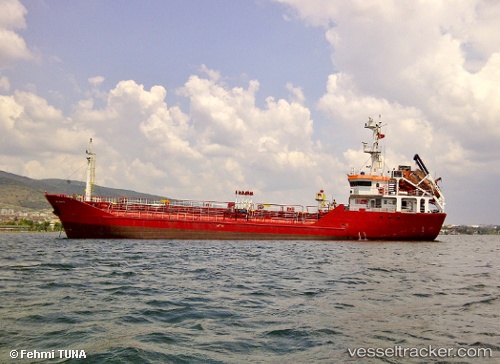
Sterling Energy
Current StatusWhere is the vessel?
Sterling Energy is currently in Near Hannon, based on AIS data received less than 1h ago.
Latest AIS update:
Current position: 43.26912° N, 79.78532° W (Near Hannon)
Average speed (last 7 days): Loading…
Average speed (last 30 days): Loading…
Vessel profile: Sterling Energy is a Chemical Oil Products Tanker with dimensions 10m x 65m.
This page combines live AIS, route history, probable destination signals, nearby traffic, and port activity for practical vessel monitoring.
The current position of vessel Sterling Energy is 43.26912 lat / -79.78532 lng. Updated: 2026-05-14 21:49:19 UTCNearest reference points:
- Near Hannon
- Near OAKVILLE
- Near TORONTO
Details:
Live Vessel Sterling Energy Analytics (details, animations, etc.)
Recent AIS points (UTC):
2026-05-14 18:04:19 UTC · 43.26913, -79.78530 · SOG 0 kn · COG -1°2026-05-14 19:34:18 UTC · 43.26913, -79.78532 · SOG 0 kn · COG -1°
2026-05-14 19:46:18 UTC · 43.26912, -79.78533 · SOG 0 kn · COG -1°
2026-05-14 21:49:19 UTC · 43.26912, -79.78532 · SOG 0 kn · COG -1°