 vesseltracker.com
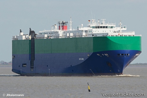
Ivory Arrow
Current StatusWhere is the vessel?
Ivory Arrow is currently in 46 nm W of Pulau Jarak, based on AIS data received about 1h ago.
Latest AIS update:
Current position: 4.21667° N, 99.36333° E (46 nm W of Pulau Jarak)
Average speed (last 7 days): Loading…
Average speed (last 30 days): Loading…
Vessel profile: Ivory Arrow is a Vehicles Carrier with dimensions 32m x 200m.
This page combines live AIS, route history, probable destination signals, nearby traffic, and port activity for practical vessel monitoring.
The current position of vessel Ivory Arrow is 4.21667 lat / 99.36333 lng. Updated: 2026-05-15 07:37:48 UTCNearest reference points:
- 43 nm NE of Perbaungan
- 10 nm NE of Belawan
- 43 nm NE of PANGKALAN SUSU
Details:
Live Vessel Ivory Arrow Analytics (details, animations, etc.)
Recent AIS points (UTC):
2026-05-15 04:28:55 UTC · 3.69500, 100.08333 · SOG 16 kn · COG -1°2026-05-15 06:04:37 UTC · 3.95890, 99.73169 · SOG 17 kn · COG 303°
2026-05-15 07:28:11 UTC · 4.18894, 99.40593 · SOG 17.6 kn · COG 307°
2026-05-15 07:37:48 UTC · 4.21667, 99.36333 · SOG 17 kn · COG -1°