 vesseltracker.com
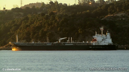
 CAPELLA
Current Status
Where is the vessel?
CAPELLA is currently in 52 nm SE of Port Saint John's, based on AIS data received less than 1h ago.
Latest AIS update:
Current position: 32.32892° S, 30.15718° E (52 nm SE of Port Saint John's)
Average speed (last 7 days): Loading…
Average speed (last 30 days): Loading…
Vessel profile: CAPELLA is a Chemical/Oil Products Tanker with dimensions 174m x 28m.
This page combines live AIS, route history, probable destination signals, nearby traffic, and port activity for practical vessel monitoring.
The current position of vessel CAPELLA is -32.32892 lat / 30.15718 lng. Updated: 2026-05-14 12:15:48 UTCNearest reference points:
- 23 nm E of Port Saint John's
- 125 nm SE of Port Edward
- Near Island View
Currently sailing under the flag of Vietnam ![]()
CAPELLA built in 2003 year
Deadweight:
32315 tDetails:
Live Vessel CAPELLA Analytics (details, animations, etc.)
Recent AIS points (UTC):
2026-05-14 07:16:27 UTC · -32.90829, 29.42575 · SOG 9.3 kn · COG 48°2026-05-14 09:24:39 UTC · -32.66672, 29.72972 · SOG 10.4 kn · COG 49°
2026-05-14 10:06:11 UTC · -32.58647, 29.82735 · SOG 9.5 kn · COG 50°
2026-05-14 12:15:48 UTC · -32.32892, 30.15718 · SOG 10.1 kn · COG 51°