 vesseltracker.com
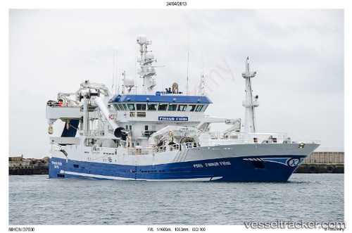
Finnur Fridi
Current StatusWhere is the vessel?
Finnur Fridi is currently in 54 nm NE of Thorshavn, based on AIS data received about 2h ago.
Latest AIS update:
Current position: 62.49230° N, 4.43940° W (54 nm NE of Thorshavn)
Average speed (last 7 days): Loading…
Average speed (last 30 days): Loading…
Vessel profile: Finnur Fridi is a Fish Carrier with dimensions 16m x 75m.
This page combines live AIS, route history, probable destination signals, nearby traffic, and port activity for practical vessel monitoring.
The current position of vessel Finnur Fridi is 62.49230 lat / -4.43940 lng. Updated: 2026-05-15 23:44:02 UTCNearest reference points:
- Near FUGLAFJORDUR
- 36 nm NW of Ham Voe, Foula
- 32 nm NW of Eshaness
Details:
Live Vessel Finnur Fridi Analytics (details, animations, etc.)
Recent AIS points (UTC):
2026-05-15 20:00:01 UTC · 62.49528, -4.86038 · SOG 7.8 kn · COG 88°2026-05-15 21:25:59 UTC · 62.44732, -4.64622 · SOG 3.8 kn · COG 170°
2026-05-15 22:42:00 UTC · 62.47783, -4.74401 · SOG 8.2 kn · COG 325°
2026-05-15 23:44:02 UTC · 62.49230, -4.43940 · SOG 9.2 kn · COG 81°