 vesseltracker.com
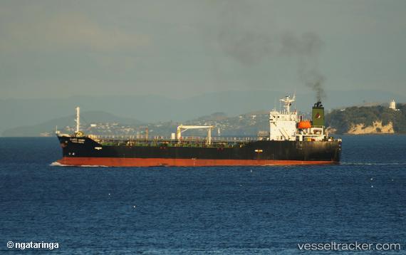
Tasco Amata
Current StatusWhere is the vessel?
Tasco Amata is currently in Near Bangpoomai, based on AIS data received less than 1h ago.
Latest AIS update:
Current position: 13.35737° N, 100.59940° E (Near Bangpoomai)
Average speed (last 7 days): Loading…
Average speed (last 30 days): Loading…
Vessel profile: Tasco Amata is a Bitumen Tanker with dimensions 20m x 105m.
This page combines live AIS, route history, probable destination signals, nearby traffic, and port activity for practical vessel monitoring.
The current position of vessel Tasco Amata is 13.35737 lat / 100.59940 lng. Updated: 2026-05-13 14:02:48 UTCNearest reference points:
- Near Bangpoomai
- Near Unithai Container Terminal
- Near NH Prosperity
Details:
Live Vessel Tasco Amata Analytics (details, animations, etc.)
Recent AIS points (UTC):
2026-05-13 10:35:48 UTC · 13.35737, 100.59928 · SOG 0 kn · COG 191°2026-05-13 11:32:48 UTC · 13.35735, 100.59930 · SOG 0 kn · COG 191°
2026-05-13 13:35:48 UTC · 13.35738, 100.59930 · SOG 0 kn · COG 193°
2026-05-13 14:02:48 UTC · 13.35737, 100.59940 · SOG 0 kn · COG 192°