 vesseltracker.com
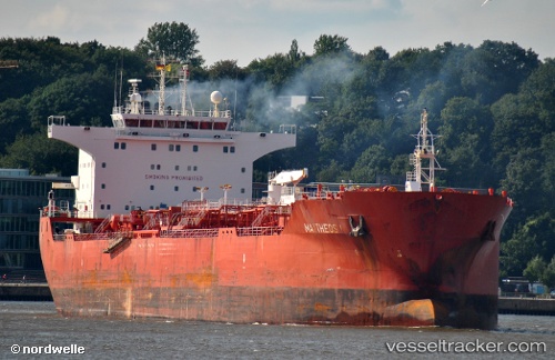
 LOUIZA
Current Status
Where is the vessel?
LOUIZA is currently in 29 nm E of SHINAS, based on AIS data received about 3h ago.
Latest AIS update:
Current position: 24.84690° N, 56.99944° E (29 nm E of SHINAS)
Average speed (last 7 days): Loading…
Average speed (last 30 days): Loading…
Vessel profile: LOUIZA is a Oil/Chemical Tanker with dimensions m x m.
This page combines live AIS, route history, probable destination signals, nearby traffic, and port activity for practical vessel monitoring.
The current position of vessel LOUIZA is 24.84690 lat / 56.99944 lng. Updated: 2026-05-15 01:33:30 UTCNearest reference points:
- 42 nm SE of Offshore Fujairah
- 18 nm SE of SHINAS
- Near Offshore Fujairah
Currently sailing under the flag of Curacao ![]()
Details:
Live Vessel LOUIZA Analytics (details, animations, etc.)
Recent AIS points (UTC):
2026-05-14 08:53:09 UTC · 25.68925, 56.98521 · SOG 1 kn · COG 347°2026-05-15 00:12:21 UTC · 24.85048, 56.98219 · SOG 0.7 kn · COG 201°
2026-05-15 01:33:30 UTC · 24.84690, 56.99944 · SOG 2.3 kn · COG 222°
2026-05-15 01:33:30 UTC · 24.84690, 56.99944 · SOG 2.3 kn · COG 222°