 vesseltracker.com
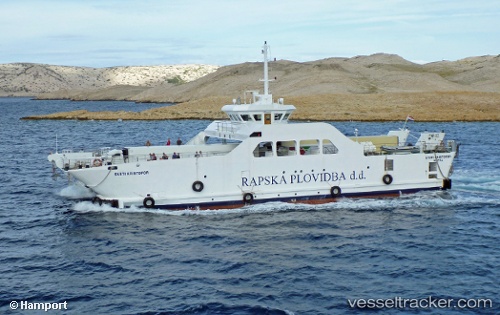
Sveti Kristofor
Current StatusWhere is the vessel?
Sveti Kristofor is currently in Near Makarska, based on AIS data received less than 1h ago.
Latest AIS update:
Current position: 43.29459° N, 17.01684° E (Near Makarska)
Average speed (last 7 days): Loading…
Average speed (last 30 days): Loading…
Vessel profile: Sveti Kristofor is a Passenger Ro Ro Cargo Ship with dimensions 16m x 34m.
This page combines live AIS, route history, probable destination signals, nearby traffic, and port activity for practical vessel monitoring.
The current position of vessel Sveti Kristofor is 43.29459 lat / 17.01684 lng. Updated: 2026-05-16 10:02:38 UTCNearest reference points:
- Near Dugi Rat
- Near Kardeljevo
- Near Stobrec
Details:
Live Vessel Sveti Kristofor Analytics (details, animations, etc.)
Recent AIS points (UTC):
2026-05-16 07:31:09 UTC · 43.28399, 16.90765 · SOG 9.4 kn · COG -1°2026-05-16 07:42:19 UTC · 43.28214, 16.87130 · SOG 9.6 kn · COG -1°
2026-05-16 09:34:09 UTC · 43.28893, 16.97571 · SOG 9.1 kn · COG -1°
2026-05-16 10:02:38 UTC · 43.29459, 17.01684 · SOG 0 kn · COG -1°