 vesseltracker.com
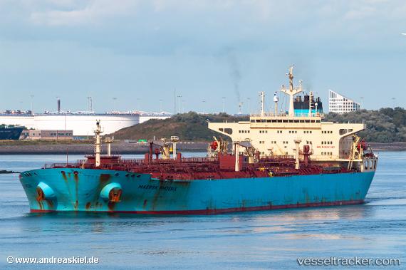
 TIBURON
Current Status
Where is the vessel?
TIBURON is currently in Near TANJUNG PELEPAS, based on AIS data received about 520d ago.
Latest AIS update:
Current position: 1.27155° N, 103.43703° E (Near TANJUNG PELEPAS)
Average speed (last 7 days): Loading…
Average speed (last 30 days): Loading…
Vessel profile: TIBURON is a Crude Oil Tanker with dimensions 244m x 42m.
This page combines live AIS, route history, probable destination signals, nearby traffic, and port activity for practical vessel monitoring.
The current position of vessel TIBURON is 1.27155 lat / 103.43703 lng. Updated: 2024-12-10 01:28:54 UTCNearest reference points:
- Near Nipah
- Near Tanjong Bin
- Near Tanjungbalai
Currently sailing under the flag of Cook Is ![]()
TIBURON built in 2005 year
Deadweight:
109571 tDetails:
Live Vessel TIBURON Analytics (details, animations, etc.)
Recent AIS points (UTC):
2024-12-10 01:28:54 UTC · 1.27155, 103.43703 · SOG 0.1 kn · COG 356°