 vesseltracker.com
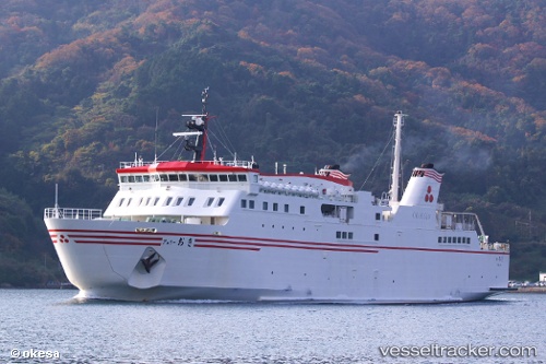
Ferry Oki
Current StatusWhere is the vessel?
Ferry Oki is currently in Near SHICHIRUI, based on AIS data received about 2h ago.
Latest AIS update:
Current position: 35.57742° N, 133.24390° E (Near SHICHIRUI)
Average speed (last 7 days): Loading…
Average speed (last 30 days): Loading…
Vessel profile: Ferry Oki is a Passenger Ro Ro Cargo Ship with dimensions 17m x 95m.
This page combines live AIS, route history, probable destination signals, nearby traffic, and port activity for practical vessel monitoring.
The current position of vessel Ferry Oki is 35.57742 lat / 133.24390 lng. Updated: 2026-05-14 08:45:56 UTCNearest reference points:
- Near FUKUYAMA
- Near Kurashiki
- 37 nm NW of NAKANOSHIMA
Details:
Live Vessel Ferry Oki Analytics (details, animations, etc.)
Recent AIS points (UTC):
2026-05-14 07:36:34 UTC · 35.89738, 133.13570 · SOG 17.8 kn · COG 161°2026-05-14 07:52:46 UTC · 35.82243, 133.16953 · SOG 17.7 kn · COG 161°
2026-05-14 08:45:56 UTC · 35.57742, 133.24390 · SOG 15 kn · COG 249°
2026-05-14 08:45:56 UTC · 35.57742, 133.24390 · SOG 15 kn · COG 249°