 vesseltracker.com
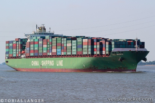
 America
Current Status
Where is the vessel?
America is currently in 42 nm E of Corvo Island Apt, based on AIS data received less than 1h ago.
Latest AIS update:
Current position: 39.88970° N, 30.22488° W (42 nm E of Corvo Island Apt)
Average speed (last 7 days): Loading…
Average speed (last 30 days): Loading…
Vessel profile: America is a Container Ship with dimensions 334m x 43m.
This page combines live AIS, route history, probable destination signals, nearby traffic, and port activity for practical vessel monitoring.
The current position of vessel America is 39.88970 lat / -30.22488 lng. Updated: 2026-04-30 11:38:41 UTCCurrently sailing under the flag of Cyprus ![]()
America built in 2004 year
Deadweight:
101612 tDetails:
Live Vessel America Analytics (details, animations, etc.)
Recent AIS points (UTC):
2026-04-30 08:21:28 UTC · 39.78302, -29.08187 · SOG 15.7 kn · COG 279°2026-04-30 09:38:52 UTC · 39.82490, -29.50932 · SOG 16.4 kn · COG 276°
2026-04-30 10:07:24 UTC · 39.83587, -29.68595 · SOG 16.4 kn · COG 277°
2026-04-30 11:38:41 UTC · 39.88970, -30.22488 · SOG 16.9 kn · COG 278°