 vesseltracker.com
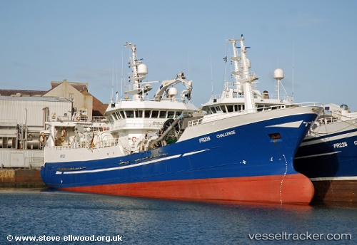
Challenge Fr226
Current StatusWhere is the vessel?
Challenge Fr226 is currently in Near CILLERO, based on AIS data received about 113d ago.
Latest AIS update:
Current position: 43.68137° N, 7.59843° W (Near CILLERO)
Average speed (last 7 days): Loading…
Average speed (last 30 days): Loading…
Vessel profile: Challenge Fr226 is a Fishing Vessel with dimensions 13m x 65m.
This page combines live AIS, route history, probable destination signals, nearby traffic, and port activity for practical vessel monitoring.
The current position of vessel Challenge Fr226 is 43.68137 lat / -7.59843 lng. Updated: 2026-01-21 14:19:26 UTCNearest reference points:
- Near Burela
- 22 nm N of Carino
- Near Milladoiro
Details:
Live Vessel Challenge Fr226 Analytics (details, animations, etc.)
Recent AIS points (UTC):
2026-01-21 14:19:26 UTC · 43.68137, -7.59843 · SOG 0 kn · COG 86°