 vesseltracker.com
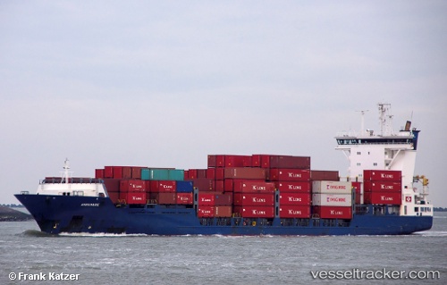
 Annamarie
Current Status
Where is the vessel?
Annamarie is currently in Near El Saler, based on AIS data received less than 1h ago.
Latest AIS update:
Current position: 39.39580° N, 0.18834° W (Near El Saler)
Average speed (last 7 days): Loading…
Average speed (last 30 days): Loading…
Vessel profile: Annamarie is a Container Ship with dimensions 138m x 21m.
This page combines live AIS, route history, probable destination signals, nearby traffic, and port activity for practical vessel monitoring.
The current position of vessel Annamarie is 39.39580 lat / -0.18834 lng. Updated: 2026-05-15 03:47:34 UTCNearest reference points:
- Near Valencia
- Near Puebla de Farnals
- Near GANDIA
Currently sailing under the flag of Portugal ![]()
Annamarie built in 2003 year
Deadweight:
8720 tDetails:
Live Vessel Annamarie Analytics (details, animations, etc.)
Recent AIS points (UTC):
2026-05-14 22:36:24 UTC · 38.73683, 0.43086 · SOG 11.7 kn · COG 345°2026-05-14 23:57:04 UTC · 38.94501, 0.23919 · SOG 12.4 kn · COG 318°
2026-05-15 01:14:14 UTC · 39.16037, 0.02718 · SOG 13.1 kn · COG 328°
2026-05-15 03:47:34 UTC · 39.39580, -0.18834 · SOG 1.5 kn · COG 50°