 vesseltracker.com
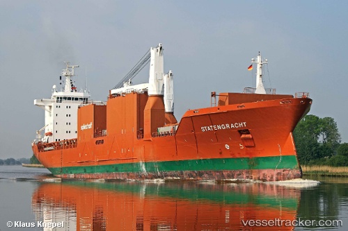
 Statengracht
Current Status
Where is the vessel?
Statengracht is currently in 101 nm SW of Crevedia, based on AIS data received about 1h ago.
Latest AIS update:
Current position: 43.76167° N, 27.97452° W (101 nm SW of Crevedia)
Average speed (last 7 days): Loading…
Average speed (last 30 days): Loading…
Vessel profile: Statengracht is a Multi Purpose Carrier with dimensions 172m x 25m.
This page combines live AIS, route history, probable destination signals, nearby traffic, and port activity for practical vessel monitoring.
The current position of vessel Statengracht is 43.76167 lat / -27.97452 lng. Updated: 2026-05-13 23:59:49 UTCCurrently sailing under the flag of Netherlands ![]()
Statengracht built in 2004 year
Deadweight:
21250 tDetails:
Live Vessel Statengracht Analytics (details, animations, etc.)
Recent AIS points (UTC):
2026-05-13 20:06:26 UTC · 44.16123, -26.78998 · SOG 14.7 kn · COG 245°2026-05-13 22:12:08 UTC · 43.94592, -27.43754 · SOG 14.3 kn · COG 245°
2026-05-13 22:16:40 UTC · 43.93859, -27.46029 · SOG 14.3 kn · COG 245°
2026-05-13 23:59:49 UTC · 43.76167, -27.97452 · SOG 14.3 kn · COG 245°