 vesseltracker.com
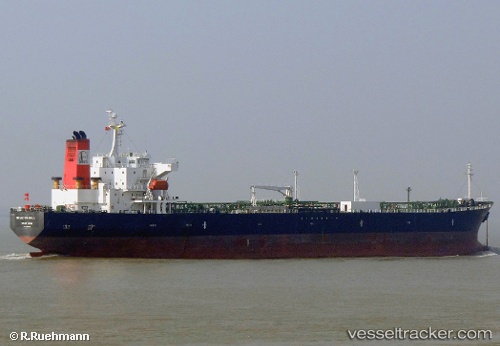
 ANNA MARIA P
Current Status
Where is the vessel?
ANNA MARIA P is currently in 60 nm SE of Ilha do Sal, based on AIS data received about 1h ago.
Latest AIS update:
Current position: 16.18147° N, 22.06722° W (60 nm SE of Ilha do Sal)
Average speed (last 7 days): Loading…
Average speed (last 30 days): Loading…
Vessel profile: ANNA MARIA P is a Oil Products Tanker with dimensions 183m x 32m.
This page combines live AIS, route history, probable destination signals, nearby traffic, and port activity for practical vessel monitoring.
The current position of vessel ANNA MARIA P is 16.18147 lat / -22.06722 lng. Updated: 2026-05-14 12:08:51 UTCNearest reference points:
- Near Ilha do Sal
- 39 nm W of Ilha do Sal
- 61 nm NW of Ilha do Sal
Currently sailing under the flag of Liberia ![]()
ANNA MARIA P built in 2005 year
Deadweight:
47278 tDetails:
Live Vessel ANNA MARIA P Analytics (details, animations, etc.)
Recent AIS points (UTC):
2026-05-14 08:00:50 UTC · 15.89167, -21.30167 · SOG 10 kn · COG -1°2026-05-14 10:13:24 UTC · 16.05264, -21.70857 · SOG 11.3 kn · COG 293°
2026-05-14 10:13:24 UTC · 16.05264, -21.70857 · SOG 11.3 kn · COG 293°
2026-05-14 12:08:51 UTC · 16.18147, -22.06722 · SOG 12 kn · COG 293°