 vesseltracker.com
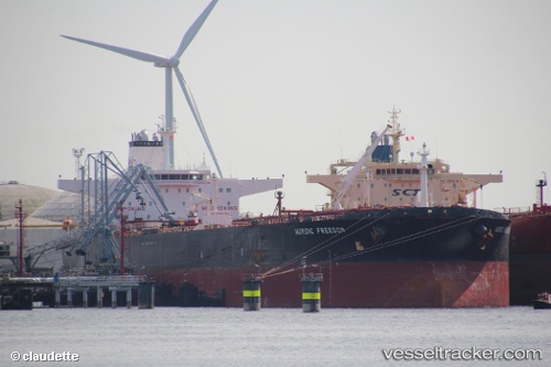
Nordic Freedom
Current StatusWhere is the vessel?
Nordic Freedom is currently in Near PENGERANG, based on AIS data received less than 1h ago.
Latest AIS update:
Current position: 1.29578° N, 104.13654° E (Near PENGERANG)
Average speed (last 7 days): Loading…
Average speed (last 30 days): Loading…
Vessel profile: Nordic Freedom is a Crude Oil Tanker with dimensions 48m x 274m.
This page combines live AIS, route history, probable destination signals, nearby traffic, and port activity for practical vessel monitoring.
The current position of vessel Nordic Freedom is 1.29578 lat / 104.13654 lng. Updated: 2026-05-14 05:25:53 UTCNearest reference points:
- Near PENGERANG
- Near TANAH MERAH
- Near Tanjung Setapa
Details:
Live Vessel Nordic Freedom Analytics (details, animations, etc.)
Recent AIS points (UTC):
2026-05-14 01:31:54 UTC · 1.29747, 104.13530 · SOG 0.1 kn · COG 213°2026-05-14 03:43:53 UTC · 1.29547, 104.13634 · SOG 0 kn · COG 276°
2026-05-14 04:49:54 UTC · 1.29545, 104.13635 · SOG 0 kn · COG 276°
2026-05-14 05:25:53 UTC · 1.29578, 104.13654 · SOG 0 kn · COG 267°