 vesseltracker.com
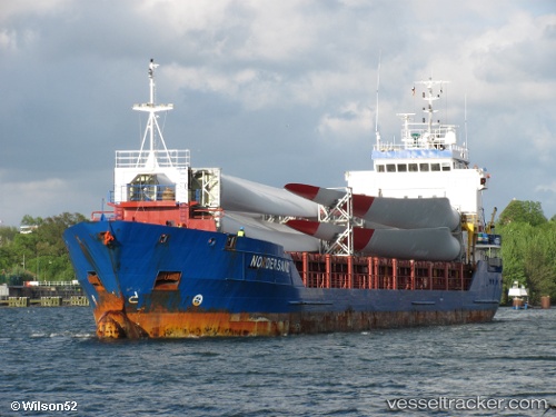
 Nordersand
Current Status
Where is the vessel?
Nordersand is currently in Near Tetney Terminal, based on AIS data received less than 1h ago.
Latest AIS update:
Current position: 53.50172° N, 0.31190° E (Near Tetney Terminal)
Average speed (last 7 days): Loading…
Average speed (last 30 days): Loading…
Vessel profile: Nordersand is a General Cargo with dimensions 99m x 14m.
This page combines live AIS, route history, probable destination signals, nearby traffic, and port activity for practical vessel monitoring.
The current position of vessel Nordersand is 53.50172 lat / 0.31190 lng. Updated: 2026-05-15 11:40:16 UTCNearest reference points:
- Near Withernsea
- Near Grimsby
- 14 nm E of Withernsea
Currently sailing under the flag of Antigua Barbuda ![]()
Nordersand built in 2004 year
Deadweight:
4512 tDetails:
ex Nordersand
ex MMSI: 236265000
Live Vessel Nordersand Analytics (details, animations, etc.)
Recent AIS points (UTC):
2026-05-15 08:11:24 UTC · 53.62793, -0.18950 · SOG 0 kn · COG -1°2026-05-15 09:23:26 UTC · 53.62888, -0.18993 · SOG 0 kn · COG -1°
2026-05-15 10:06:26 UTC · 53.59631, -0.03984 · SOG 13.4 kn · COG -1°
2026-05-15 11:40:16 UTC · 53.50172, 0.31190 · SOG 9.5 kn · COG 125°