 vesseltracker.com
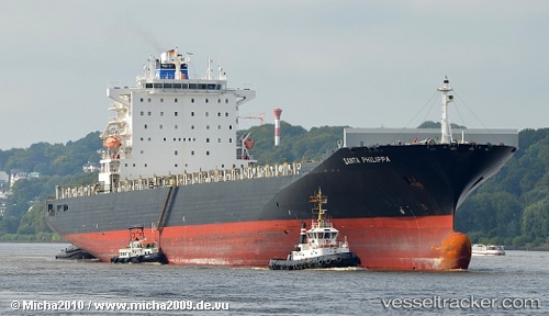
 MSC SANTA MARIA
Current Status
Where is the vessel?
MSC SANTA MARIA is currently in 26 nm NE of Scauri Alto, based on AIS data received less than 1h ago.
Latest AIS update:
Current position: 36.99849° N, 12.42278° E (26 nm NE of Scauri Alto)
Average speed (last 7 days): Loading…
Average speed (last 30 days): Loading…
Vessel profile: MSC SANTA MARIA is a Container Ship with dimensions 32m x 294m.
This page combines live AIS, route history, probable destination signals, nearby traffic, and port activity for practical vessel monitoring.
The current position of vessel MSC SANTA MARIA is 36.99849 lat / 12.42278 lng. Updated: 2026-05-15 19:10:04 UTCNearest reference points:
- Near MARSALA
- Near Trapani
- Near Balestrate
Currently sailing under the flag of Panama ![]()
MSC SANTA MARIA built in 2005 year
Deadweight:
67273 tDetails:
Live Vessel MSC SANTA MARIA Analytics (details, animations, etc.)
Recent AIS points (UTC):
2026-05-15 15:35:33 UTC · 37.31183, 11.30648 · SOG 14.9 kn · COG 108°2026-05-15 16:42:57 UTC · 37.21746, 11.66072 · SOG 16 kn · COG 106°
2026-05-15 17:52:33 UTC · 37.11395, 12.02815 · SOG 16.2 kn · COG 111°
2026-05-15 19:10:04 UTC · 36.99849, 12.42278 · SOG 15.9 kn · COG 110°