 vesseltracker.com
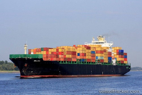
 Bellavia
Current Status
Where is the vessel?
Bellavia is currently in Near Nam Hai Dinh Vu Port, based on AIS data received about 1h ago.
Latest AIS update:
Current position: 20.79770° N, 106.90967° E (Near Nam Hai Dinh Vu Port)
Average speed (last 7 days): Loading…
Average speed (last 30 days): Loading…
Vessel profile: Bellavia is a Container Ship with dimensions 294m x 32m.
This page combines live AIS, route history, probable destination signals, nearby traffic, and port activity for practical vessel monitoring.
The current position of vessel Bellavia is 20.79770 lat / 106.90967 lng. Updated: 2026-04-30 17:36:18 UTCNearest reference points:
- Near Nam Hai Dinh Vu Port
- Near HAI PHONG
- Near Dinh Vu Terminal
Currently sailing under the flag of Liberia ![]()
Bellavia built in 2005 year
Deadweight:
66478 tDetails:
Live Vessel Bellavia Analytics (details, animations, etc.)
Recent AIS points (UTC):
2026-04-30 13:56:12 UTC · 20.50730, 107.16960 · SOG 10.2 kn · COG 297°2026-04-30 15:44:38 UTC · 20.63210, 106.90032 · SOG 6.3 kn · COG 70°
2026-04-30 16:13:15 UTC · 20.64257, 107.00073 · SOG 12.7 kn · COG 75°
2026-04-30 17:36:18 UTC · 20.79770, 106.90967 · SOG 0.3 kn · COG 327°