 vesseltracker.com
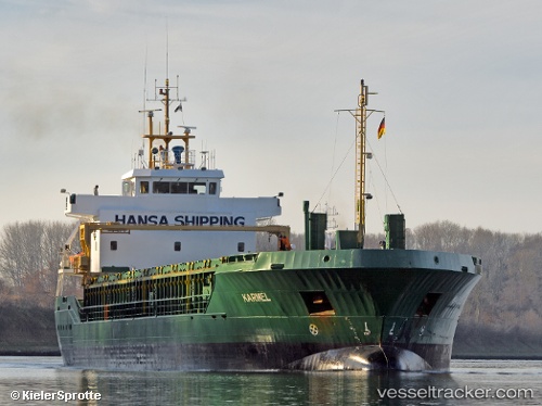
 KARMEL
Current Status
Where is the vessel?
KARMEL is currently in Near Bremen, based on AIS data received less than 1h ago.
Latest AIS update:
Current position: 53.10888° N, 8.75565° E (Near Bremen)
Average speed (last 7 days): Loading…
Average speed (last 30 days): Loading…
Vessel profile: KARMEL is a General Cargo with dimensions m x m.
This page combines live AIS, route history, probable destination signals, nearby traffic, and port activity for practical vessel monitoring.
The current position of vessel KARMEL is 53.10888 lat / 8.75565 lng. Updated: 2026-05-16 05:23:38 UTCNearest reference points:
- Near HASENBURENER DEICH
- Near Hemelingen
- Near Brake
Currently sailing under the flag of Antigua and Barbuda ![]()
Details:
Live Vessel KARMEL Analytics (details, animations, etc.)
Recent AIS points (UTC):
2026-05-16 01:49:40 UTC · 53.10887, 8.75565 · SOG 0 kn · COG 262°2026-05-16 03:22:37 UTC · 53.10888, 8.75565 · SOG 0 kn · COG 262°
2026-05-16 04:01:37 UTC · 53.10888, 8.75563 · SOG 0 kn · COG 262°
2026-05-16 05:23:38 UTC · 53.10888, 8.75565 · SOG 0 kn · COG 262°