 vesseltracker.com
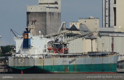
 New Horizon
Current Status
Where is the vessel?
New Horizon is currently in Near Mutrah, based on AIS data received less than 1h ago.
Latest AIS update:
Current position: 23.68141° N, 58.56569° E (Near Mutrah)
Average speed (last 7 days): Loading…
Average speed (last 30 days): Loading…
Vessel profile: New Horizon is a Bulk Carrier with dimensions 225m x 225m.
This page combines live AIS, route history, probable destination signals, nearby traffic, and port activity for practical vessel monitoring.
The current position of vessel New Horizon is 23.68141 lat / 58.56569 lng. Updated: 2026-05-14 03:55:17 UTCNearest reference points:
- 58 nm S of JASK
- 23 nm NE of Qalhat
- 42 nm SE of Offshore Fujairah
Currently sailing under the flag of Panama ![]()
New Horizon built in 2004 year
Deadweight:
77000 tDetails:
Live Vessel New Horizon Analytics (details, animations, etc.)
Recent AIS points (UTC):
2026-05-13 21:30:37 UTC · 23.68500, 58.56667 · SOG 0 kn · COG -1°2026-05-14 00:42:40 UTC · 23.68167, 58.56833 · SOG 0 kn · COG -1°
2026-05-14 00:42:40 UTC · 23.68167, 58.56833 · SOG 0 kn · COG -1°
2026-05-14 03:55:17 UTC · 23.68141, 58.56569 · SOG 0.2 kn · COG 29°