 vesseltracker.com
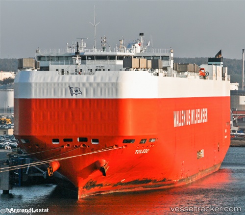
Toledo
Current StatusWhere is the vessel?
Toledo is currently in 55 nm N of ISLA MUJERES, based on AIS data received less than 1h ago.
Latest AIS update:
Current position: 22.12342° N, 87.06314° W (55 nm N of ISLA MUJERES)
Average speed (last 7 days): Loading…
Average speed (last 30 days): Loading…
Vessel profile: Toledo is a Vehicles Carrier with dimensions 32m x 199m.
This page combines live AIS, route history, probable destination signals, nearby traffic, and port activity for practical vessel monitoring.
The current position of vessel Toledo is 22.12342 lat / -87.06314 lng. Updated: 2026-05-14 06:08:27 UTCNearest reference points:
- Near Puerto Juárez
Details:
Live Vessel Toledo Analytics (details, animations, etc.)
Recent AIS points (UTC):
2026-05-14 00:46:19 UTC · 21.49444, -85.73295 · SOG 16.3 kn · COG 319°2026-05-14 03:48:44 UTC · 22.05210, -86.37878 · SOG 16.6 kn · COG 274°
2026-05-14 04:17:49 UTC · 22.07083, -86.52115 · SOG 16.3 kn · COG 266°
2026-05-14 06:08:27 UTC · 22.12342, -87.06314 · SOG 16.5 kn · COG 282°