 vesseltracker.com
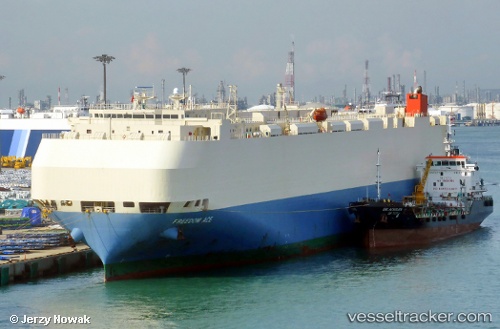
 Freedom Ace
Current Status
Where is the vessel?
Freedom Ace is currently in 89 nm W of Loreto, based on AIS data received less than 1h ago.
Latest AIS update:
Current position: 25.83000° N, 114.24667° W (89 nm W of Loreto)
Average speed (last 7 days): Loading…
Average speed (last 30 days): Loading…
Vessel profile: Freedom Ace is a Vehicles Carrier with dimensions 200m x 200m.
This page combines live AIS, route history, probable destination signals, nearby traffic, and port activity for practical vessel monitoring.
The current position of vessel Freedom Ace is 25.83000 lat / -114.24667 lng. Updated: 2026-04-24 19:35:52 UTCNearest reference points:
- 38 nm W of Loreto
Currently sailing under the flag of Japan ![]()
Freedom Ace built in 2005 year
Deadweight:
19093 tDetails:
Live Vessel Freedom Ace Analytics (details, animations, etc.)
Recent AIS points (UTC):
2026-04-24 16:18:36 UTC · 25.12947, -113.59164 · SOG 18.6 kn · COG 320°2026-04-24 17:32:59 UTC · 25.38858, -113.84541 · SOG 16.1 kn · COG 321°
2026-04-24 19:35:52 UTC · 25.83000, -114.24667 · SOG 17 kn · COG -1°
2026-04-24 19:35:52 UTC · 25.83000, -114.24667 · SOG 17 kn · COG -1°