 vesseltracker.com
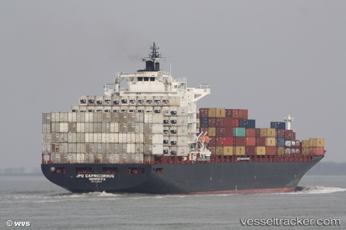
 SC MONTREUX
Current Status
Where is the vessel?
SC MONTREUX is currently in 67 nm NE of TRYPHENA, based on AIS data received less than 1h ago.
Latest AIS update:
Current position: 35.76394° S, 176.68637° E (67 nm NE of TRYPHENA)
Average speed (last 7 days): Loading…
Average speed (last 30 days): Loading…
Vessel profile: SC MONTREUX is a Container Ship with dimensions 263m x 32m.
This page combines live AIS, route history, probable destination signals, nearby traffic, and port activity for practical vessel monitoring.
The current position of vessel SC MONTREUX is -35.76394 lat / 176.68637 lng. Updated: 2026-05-15 10:30:29 UTCNearest reference points:
- 125 nm NE of TRYPHENA
- Near WHITIANGA
- Near Matiatia Bay
Currently sailing under the flag of Marshall Islands ![]()
SC MONTREUX built in 2005 year
Deadweight:
52863 tDetails:
Live Vessel SC MONTREUX Analytics (details, animations, etc.)
Recent AIS points (UTC):
2026-05-15 07:26:01 UTC · -36.48995, 177.52127 · SOG 19.4 kn · COG 315°2026-05-15 07:41:05 UTC · -36.43191, 177.45052 · SOG 19.3 kn · COG 316°
2026-05-15 09:23:00 UTC · -36.02645, 176.99141 · SOG 19.4 kn · COG 315°
2026-05-15 10:30:29 UTC · -35.76394, 176.68637 · SOG 19.1 kn · COG 314°