 vesseltracker.com
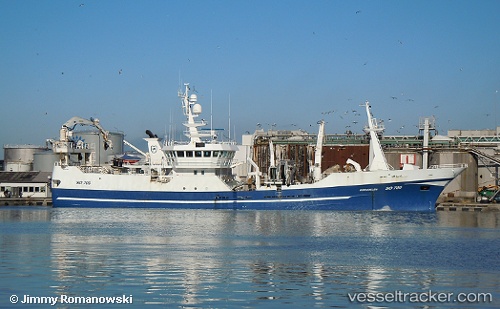
 Brendelen So709
Current Status
Where is the vessel?
Brendelen So709 is currently in Near Torshavn, based on AIS data received less than 1h ago.
Latest AIS update:
Current position: 62.00713° N, 6.77288° W (Near Torshavn)
Average speed (last 7 days): Loading…
Average speed (last 30 days): Loading…
Vessel profile: Brendelen So709 is a Fish Carrier with dimensions 64m x 12m.
This page combines live AIS, route history, probable destination signals, nearby traffic, and port activity for practical vessel monitoring.
The current position of vessel Brendelen So709 is 62.00713 lat / -6.77288 lng. Updated: 2026-04-25 01:31:54 UTCNearest reference points:
- Near FUGLAFJORDUR
- Near VESTMANNA
- 20 nm S of Vágur
Currently sailing under the flag of Ireland ![]()
Brendelen So709 built in 2004 year
Details:
Live Vessel Brendelen So709 Analytics (details, animations, etc.)
Recent AIS points (UTC):
2026-04-24 22:44:31 UTC · 62.00712, -6.77287 · SOG 0 kn · COG 59°2026-04-24 23:56:51 UTC · 62.00710, -6.77287 · SOG 0 kn · COG 59°
2026-04-25 01:31:54 UTC · 62.00713, -6.77288 · SOG 0 kn · COG 59°
2026-04-25 01:31:54 UTC · 62.00713, -6.77288 · SOG 0 kn · COG 59°