 vesseltracker.com
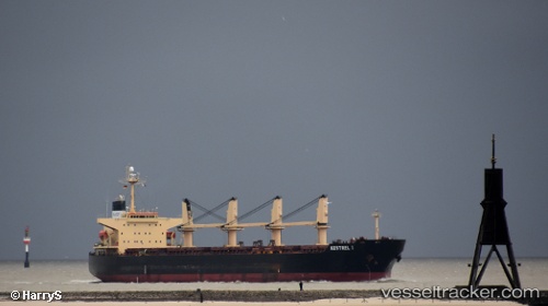
 DA HONG 16
Current Status
Where is the vessel?
DA HONG 16 is currently in 243 nm SW of LHOKNGA, based on AIS data received about 1h ago.
Latest AIS update:
Current position: 3.59167° N, 91.63833° E (243 nm SW of LHOKNGA)
Average speed (last 7 days): Loading…
Average speed (last 30 days): Loading…
Vessel profile: DA HONG 16 is a Bulk Carrier with dimensions 32m x 190m.
This page combines live AIS, route history, probable destination signals, nearby traffic, and port activity for practical vessel monitoring.
The current position of vessel DA HONG 16 is 3.59167 lat / 91.63833 lng. Updated: 2026-04-26 05:26:44 UTCNearest reference points:
- 172 nm W of LHOKNGA
- 243 nm E of Abakaliki
Currently sailing under the flag of Panama ![]()
DA HONG 16 built in 2004 year
Deadweight:
50351 tDetails:
Live Vessel DA HONG 16 Analytics (details, animations, etc.)
Recent AIS points (UTC):
2026-04-26 01:44:41 UTC · 3.18500, 91.09167 · SOG 10 kn · COG -1°2026-04-26 03:44:47 UTC · 3.40167, 91.38833 · SOG 11 kn · COG -1°
2026-04-26 03:44:47 UTC · 3.40167, 91.38833 · SOG 11 kn · COG -1°
2026-04-26 05:26:44 UTC · 3.59167, 91.63833 · SOG 10 kn · COG -1°