 vesseltracker.com
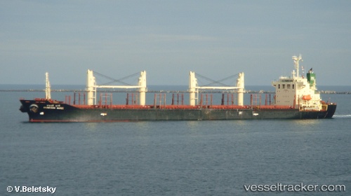
 MANSOUR M
Current Status
Where is the vessel?
MANSOUR M is currently in 19 nm SW of Paphos, based on AIS data received less than 1h ago.
Latest AIS update:
Current position: 34.55962° N, 32.11080° E (19 nm SW of Paphos)
Average speed (last 7 days): Loading…
Average speed (last 30 days): Loading…
Vessel profile: MANSOUR M is a Bulk Carrier with dimensions m x m.
This page combines live AIS, route history, probable destination signals, nearby traffic, and port activity for practical vessel monitoring.
The current position of vessel MANSOUR M is 34.55962 lat / 32.11080 lng. Updated: 2026-05-16 07:34:45 UTCNearest reference points:
- 11 nm SE of Paphos
- 68 nm SW of Paphos
- Near Limassol
Currently sailing under the flag of San Marino ![]()
Details:
Live Vessel MANSOUR M Analytics (details, animations, etc.)
Recent AIS points (UTC):
2026-05-16 03:37:36 UTC · 34.34248, 32.91218 · SOG 9.9 kn · COG 288°2026-05-16 04:14:45 UTC · 34.37277, 32.79028 · SOG 10.3 kn · COG 288°
2026-05-16 05:47:25 UTC · 34.45705, 32.47415 · SOG 10.8 kn · COG 288°
2026-05-16 07:34:45 UTC · 34.55962, 32.11080 · SOG 10.4 kn · COG 288°