 vesseltracker.com
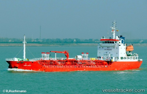
 HARMONY APOLLO
Current Status
Where is the vessel?
HARMONY APOLLO is currently in 53 nm NE of PENGERANG, based on AIS data received about 7h ago.
Latest AIS update:
Current position: 2.02358° N, 104.72335° E (53 nm NE of PENGERANG)
Average speed (last 7 days): Loading…
Average speed (last 30 days): Loading…
Vessel profile: HARMONY APOLLO is a Oil/Chemical Tanker with dimensions m x m.
This page combines live AIS, route history, probable destination signals, nearby traffic, and port activity for practical vessel monitoring.
The current position of vessel HARMONY APOLLO is 2.02358 lat / 104.72335 lng. Updated: 2026-05-14 20:34:35 UTCNearest reference points:
- 53 nm NE of PENGERANG
- 52 nm NE of PENGERANG
- 47 nm NE of PENGERANG
Currently sailing under the flag of Bahamas ![]()
Details:
Live Vessel HARMONY APOLLO Analytics (details, animations, etc.)
Recent AIS points (UTC):
2026-05-14 20:10:19 UTC · 1.95427, 104.71980 · SOG 10 kn · COG 354°2026-05-14 20:34:35 UTC · 2.02358, 104.72335 · SOG 10.1 kn · COG 3°
2026-05-14 20:34:35 UTC · 2.02358, 104.72335 · SOG 10.1 kn · COG 3°
2026-05-14 20:34:35 UTC · 2.02358, 104.72335 · SOG 10.1 kn · COG 3°