 vesseltracker.com
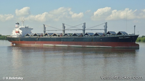
 CAMELLIA 8
Current Status
Where is the vessel?
CAMELLIA 8 is currently in 22 nm NE of Lianyungang, based on AIS data received about 1h ago.
Latest AIS update:
Current position: 34.91779° N, 119.85167° E (22 nm NE of Lianyungang)
Average speed (last 7 days): Loading…
Average speed (last 30 days): Loading…
Vessel profile: CAMELLIA 8 is a Bulk Carrier with dimensions m x m.
This page combines live AIS, route history, probable destination signals, nearby traffic, and port activity for practical vessel monitoring.
The current position of vessel CAMELLIA 8 is 34.91779 lat / 119.85167 lng. Updated: 2026-04-27 12:17:44 UTCNearest reference points:
- 18 nm E of Lianyungang
- 18 nm N of CHENJIAGANG
- 30 nm NE of CHENJIAGANG
Currently sailing under the flag of Panama ![]()
Details:
Live Vessel CAMELLIA 8 Analytics (details, animations, etc.)
Recent AIS points (UTC):
2026-04-27 07:37:51 UTC · 34.98394, 120.45589 · SOG 12 kn · COG 270°2026-04-27 09:35:34 UTC · 34.95411, 119.97167 · SOG 12.8 kn · COG 239°
2026-04-27 11:05:46 UTC · 34.91880, 119.85284 · SOG 0.1 kn · COG 334°
2026-04-27 12:17:44 UTC · 34.91779, 119.85167 · SOG 0 kn · COG 352°