 vesseltracker.com
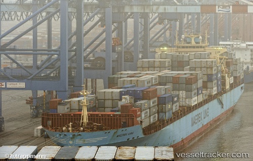
Maersk Iowa
Current StatusWhere is the vessel?
Maersk Iowa is currently in 12 nm SE of Castletown, based on AIS data received less than 1h ago.
Latest AIS update:
Current position: 50.41427° N, 2.26391° W (12 nm SE of Castletown)
Average speed (last 7 days): Loading…
Average speed (last 30 days): Loading…
Vessel profile: Maersk Iowa is a Container Ship with dimensions 32m x 292m.
This page combines live AIS, route history, probable destination signals, nearby traffic, and port activity for practical vessel monitoring.
The current position of vessel Maersk Iowa is 50.41427 lat / -2.26391 lng. Updated: 2026-04-26 03:49:25 UTCNearest reference points:
- Near Castletown
- Near WEYMOUTH
- Near Poole
Details:
Live Vessel Maersk Iowa Analytics (details, animations, etc.)
Recent AIS points (UTC):
2026-04-26 00:11:35 UTC · 50.45323, -1.04211 · SOG 14.8 kn · COG 261°2026-04-26 01:37:53 UTC · 50.40640, -1.56908 · SOG 13.6 kn · COG 267°
2026-04-26 02:33:19 UTC · 50.40635, -1.86263 · SOG 12.8 kn · COG 271°
2026-04-26 03:49:25 UTC · 50.41427, -2.26391 · SOG 12.8 kn · COG 259°