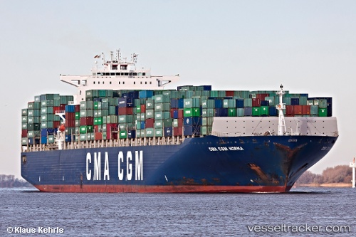
 CMA CGM NORMA
Current Status
Where is the vessel?
CMA CGM NORMA is currently in 104 nm SE of Tepanje, based on AIS data received about 14h ago.
Latest AIS update:
Current position: 44.94810° N, 154.87100° E (104 nm SE of Tepanje)
Average speed (last 7 days): Loading…
Average speed (last 30 days): Loading…
Vessel profile: CMA CGM NORMA is a Container Ship with dimensions 349m x 349m.
This page combines live AIS, route history, probable destination signals, nearby traffic, and port activity for practical vessel monitoring.
The current position of vessel CMA CGM NORMA is 44.9481 lat / 154.871 lng. Updated: 2026-05-24 04:48:47 UTCCurrently sailing under the flag of Malta ![]()
CMA CGM NORMA built in 2006 year
Deadweight:
113909 tDetails:
Live Vessel CMA CGM NORMA Analytics (details, animations, etc.)
Recent AIS points (UTC):
2026-05-24 01:37:09 UTC · 44.69680, 153.74600 · SOG 15.5 kn · COG 71°2026-05-24 02:00:28 UTC · 44.72660, 153.88000 · SOG 15.4 kn · COG 70°
2026-05-24 04:23:59 UTC · 44.91500, 154.72200 · SOG 16 kn · COG -1°
2026-05-24 04:48:47 UTC · 44.94810, 154.87100 · SOG 16.2 kn · COG 73°