 vesseltracker.com
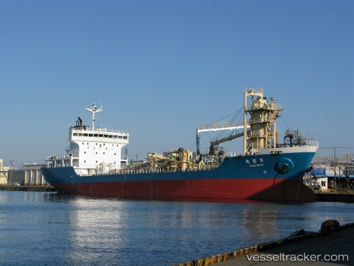
 Aobamaru
Current Status
Where is the vessel?
Aobamaru is currently in Near Hakodate, based on AIS data received about 1h ago.
Latest AIS update:
Current position: 41.78379° N, 140.66945° E (Near Hakodate)
Average speed (last 7 days): Loading…
Average speed (last 30 days): Loading…
Vessel profile: Aobamaru is a Cement Carrier with dimensions 113m x 18m.
This page combines live AIS, route history, probable destination signals, nearby traffic, and port activity for practical vessel monitoring.
The current position of vessel Aobamaru is 41.78379 lat / 140.66945 lng. Updated: 2026-05-14 23:40:16 UTCNearest reference points:
- Near Muroran
- 23 nm NE of SAI
- 11 nm NW of Yokohama, Aomori
Currently sailing under the flag of Japan ![]()
Aobamaru built in 2003 year
Deadweight:
7269 tDetails:
Live Vessel Aobamaru Analytics (details, animations, etc.)
Recent AIS points (UTC):
2026-05-14 20:22:16 UTC · 41.78223, 140.66891 · SOG 0 kn · COG 52°2026-05-14 21:46:16 UTC · 41.78313, 140.66879 · SOG 0.1 kn · COG 112°
2026-05-14 22:16:16 UTC · 41.78380, 140.67001 · SOG 0 kn · COG 193°
2026-05-14 23:40:16 UTC · 41.78379, 140.66945 · SOG 0 kn · COG 166°