 vesseltracker.com
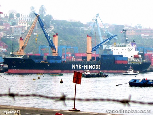
Iyo
Current StatusWhere is the vessel?
Iyo is currently in 360 nm W of Cedros Island, based on AIS data received less than 1h ago.
Latest AIS update:
Current position: 27.16165° N, 121.89504° W (360 nm W of Cedros Island)
Average speed (last 7 days): Loading…
Average speed (last 30 days): Loading…
Vessel profile: Iyo is a Multi Purpose Carrier with dimensions 24m x 149m.
This page combines live AIS, route history, probable destination signals, nearby traffic, and port activity for practical vessel monitoring.
The current position of vessel Iyo is 27.16165 lat / -121.89504 lng. Updated: 2026-05-13 19:19:03 UTCNearest reference points:
- Open sea, approx. 407 nm off the nearest listed port
- Open sea, approx. 405 nm off the nearest listed port
- Open sea, approx. 403 nm off the nearest listed port
Details:
Live Vessel Iyo Analytics (details, animations, etc.)
Recent AIS points (UTC):
2026-05-13 15:29:47 UTC · 27.01150, -121.17696 · SOG 10.6 kn · COG 286°2026-05-13 16:14:15 UTC · 27.04155, -121.31874 · SOG 10.5 kn · COG 283°
2026-05-13 18:05:53 UTC · 27.12680, -121.66174 · SOG 10.5 kn · COG 279°
2026-05-13 19:19:03 UTC · 27.16165, -121.89504 · SOG 10.8 kn · COG 283°