 vesseltracker.com
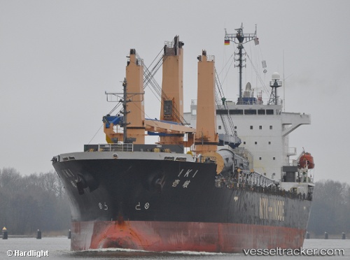
Iki
Current StatusWhere is the vessel?
Iki is currently in Near Mumbai, based on AIS data received less than 1h ago.
Latest AIS update:
Current position: 18.94429° N, 72.84358° E (Near Mumbai)
Average speed (last 7 days): Loading…
Average speed (last 30 days): Loading…
Vessel profile: Iki is a Multi Purpose Carrier with dimensions 24m x 150m.
This page combines live AIS, route history, probable destination signals, nearby traffic, and port activity for practical vessel monitoring.
The current position of vessel Iki is 18.94429 lat / 72.84358 lng. Updated: 2026-05-02 13:40:43 UTCNearest reference points:
- Near Mumbai
- Near HNB SEZ/Mumbai
- Near NHAVA SHEVA
Details:
Live Vessel Iki Analytics (details, animations, etc.)
Recent AIS points (UTC):
2026-05-02 09:46:37 UTC · 18.94428, 72.84363 · SOG 0 kn · COG 194°2026-05-02 10:43:37 UTC · 18.94427, 72.84361 · SOG 0 kn · COG 194°
2026-05-02 11:34:36 UTC · 18.94429, 72.84359 · SOG 0 kn · COG 194°
2026-05-02 13:40:43 UTC · 18.94429, 72.84358 · SOG 0 kn · COG 194°