 vesseltracker.com
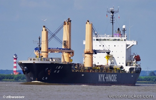
Ibi
Current StatusWhere is the vessel?
Ibi is currently in 88 nm W of Sebang, based on AIS data received less than 1h ago.
Latest AIS update:
Current position: 6.03369° N, 93.83229° E (88 nm W of Sebang)
Average speed (last 7 days): Loading…
Average speed (last 30 days): Loading…
Vessel profile: Ibi is a Multi Purpose Carrier with dimensions 24m x 149m.
This page combines live AIS, route history, probable destination signals, nearby traffic, and port activity for practical vessel monitoring.
The current position of vessel Ibi is 6.03369 lat / 93.83229 lng. Updated: 2026-05-15 07:33:00 UTCNearest reference points:
- 80 nm W of Sebang
- 48 nm NW of Sebang
- 160 nm W of Sebang
Details:
Live Vessel Ibi Analytics (details, animations, etc.)
Recent AIS points (UTC):
2026-05-15 03:30:59 UTC · 6.05548, 93.07272 · SOG 10.7 kn · COG 93°2026-05-15 04:21:50 UTC · 6.05071, 93.23158 · SOG 11.6 kn · COG 93°
2026-05-15 05:22:10 UTC · 6.04669, 93.42579 · SOG 11.2 kn · COG 94°
2026-05-15 07:33:00 UTC · 6.03369, 93.83229 · SOG 11 kn · COG 93°