 vesseltracker.com
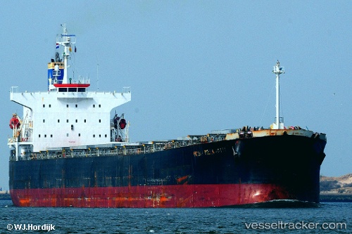
Navios Harmony
Current StatusWhere is the vessel?
Navios Harmony is currently in 197 nm NW of Bolinao, based on AIS data received less than 1h ago.
Latest AIS update:
Current position: 17.75833° N, 116.77333° E (197 nm NW of Bolinao)
Average speed (last 7 days): Loading…
Average speed (last 30 days): Loading…
Vessel profile: Navios Harmony is a Bulk Carrier with dimensions 33m x 229m.
This page combines live AIS, route history, probable destination signals, nearby traffic, and port activity for practical vessel monitoring.
The current position of vessel Navios Harmony is 17.75833 lat / 116.77333 lng. Updated: 2026-04-28 23:35:21 UTCNearest reference points:
- 138 nm NW of Bolinao
- 222 nm W of Iba
- 148 nm SE of Xijiang
Details:
Live Vessel Navios Harmony Analytics (details, animations, etc.)
Recent AIS points (UTC):
2026-04-28 19:47:20 UTC · 17.15500, 117.21500 · SOG 11 kn · COG -1°2026-04-28 21:56:22 UTC · 17.50167, 116.96333 · SOG 11 kn · COG -1°
2026-04-28 22:02:28 UTC · 17.51667, 116.95167 · SOG 11 kn · COG -1°
2026-04-28 23:35:21 UTC · 17.75833, 116.77333 · SOG 11 kn · COG -1°