 vesseltracker.com
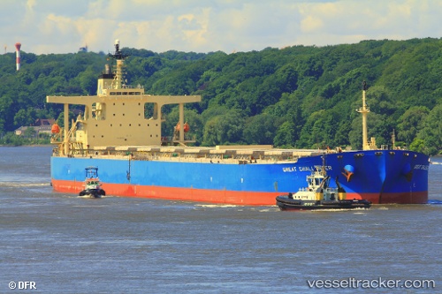
 ASL EARTH
Current Status
Where is the vessel?
ASL EARTH is currently in 17 nm E of Snohvit, based on AIS data received about 1h ago.
Latest AIS update:
Current position: 71.53965° N, 22.25916° E (17 nm E of Snohvit)
Average speed (last 7 days): Loading…
Average speed (last 30 days): Loading…
Vessel profile: ASL EARTH is a Bulk Carrier with dimensions 289m x 45m.
This page combines live AIS, route history, probable destination signals, nearby traffic, and port activity for practical vessel monitoring.
The current position of vessel ASL EARTH is 71.53965 lat / 22.25916 lng. Updated: 2026-05-14 00:15:09 UTCNearest reference points:
- Near SORVAR
- Near OKSFJORD
- 11 nm NW of ALTA
Currently sailing under the flag of Liberia ![]()
ASL EARTH built in 2005 year
Deadweight:
176279 tDetails:
Live Vessel ASL EARTH Analytics (details, animations, etc.)
Recent AIS points (UTC):
2026-05-13 20:16:18 UTC · 71.64709, 24.06172 · SOG 9 kn · COG 265°2026-05-13 21:34:28 UTC · 71.61320, 23.45681 · SOG 8.7 kn · COG 257°
2026-05-13 22:41:58 UTC · 71.58174, 22.95251 · SOG 8.6 kn · COG 260°
2026-05-14 00:15:09 UTC · 71.53965, 22.25916 · SOG 8.8 kn · COG 247°